

1
2
3
4
For decades, a concrete dam formed a farm pond and contributed to the disconnection of the floodplain.
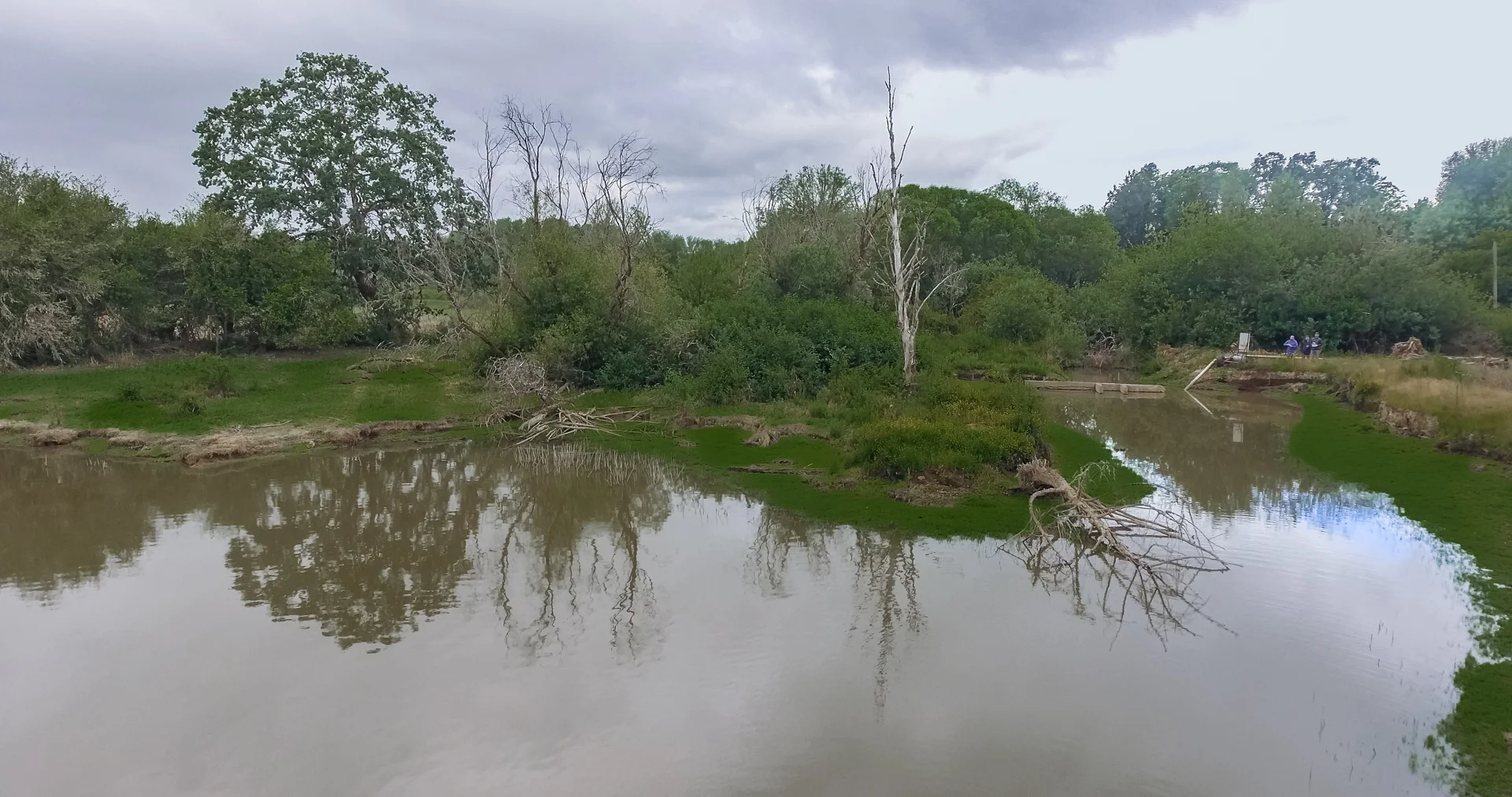
The concrete dam has been removed, but the farm pond hasn’t disappeared—thanks to beaver activity
The concrete dam has been removed, but the obsolete farm pond hasn’t entirely disappeared—thanks to beaver activity in Wapato Creek.
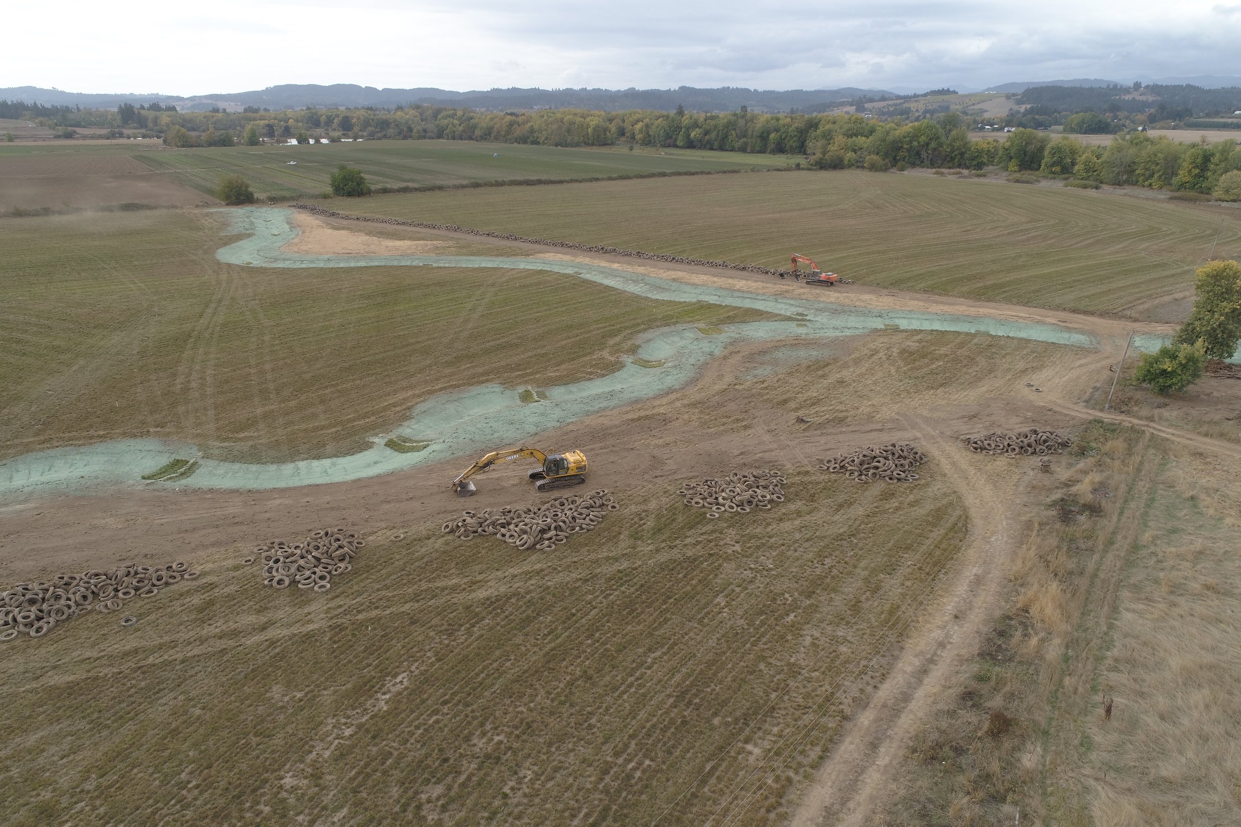
After unearthing thousands of tires, crews created meandering channels that allow the water to follow a more natural path
After unearthing thousands of tires, crews created meandering channels that allow the water to follow a more natural path.
Five creeks touch Spring Hill Natural Area; all had been channeled underground and/or ditched
Five creeks touch Spring Hill Natural Area; most had been channeled underground and/or ditched.