Between 2005 and 2025, Tree for All Partners restored more than 150 riparian miles and planted more than 17 million native trees and shrubs. More than 40 case studies were published to document the efforts that made it possible.
Improving the Resilience of Butternut Creek
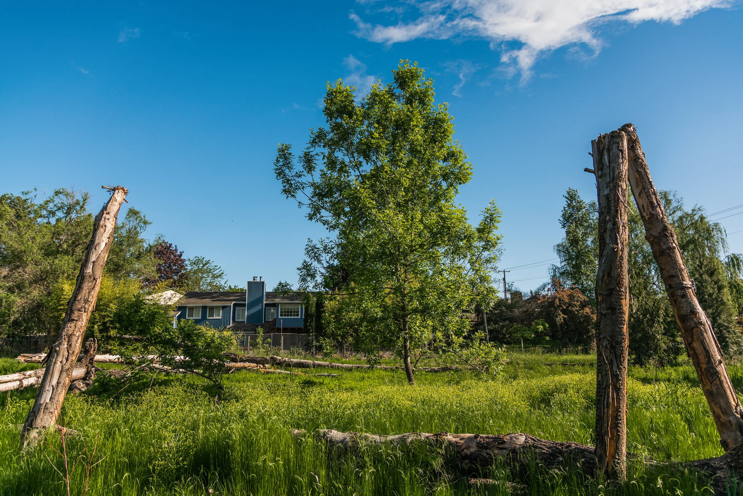
Decades ago, Butternut Creek meandered from Cooper Mountain through forests and farms to its confluence with the Tualatin River. The swampy and complex creek swelled in the rainy season and dwindled in the heat of summer but supported beavers, waterfowl, fish and amphibians. After years of change by agriculture, transportation and housing or business development, the creek was reduced to a single-thread, heavily incised creek disconnected from the floodplain and lined with invasive reed canary grass, English ivy, and non-native blackberries. In some areas, houses, roads and businesses were so close to the creek that any kind of flooding would generate consequences. The area between 198th and 209th, however, was wide enough to support a creek that resembled the older generation of complexity and function.
To address stormwater impacts of new road expansion nearby, this area has begun a multi-phased, multi-year enhancement process to return more of these original conditions and functions.


The Site
First planting: 2021
Size: 18 acres (Reach 1 = 4.3 acres)
Stream length: Butternut Creek 880 ft.; Celebrity Creek 300 ft.
Plant Communities: Shrub Wetland, Riparian Forest, Emergent Marsh

The Challenge
As Butternut Creek flows west under SW 198th Avenue in Aloha, it passes through development that predates the Clean Water Act on both sides. During high water events, the creek often impacts private and public properties upstream, challenging floodplains that include backyards and sometimes structures. In some instances, normal beaver dams have also created backyard flooding issues.
As Washington County’s Department of Land Use and Transportation strategized about how to widen SW 198th Avenue, a major thoroughfare, and add two bridges, partners joined to plan for the stresses that new stormwater from the road would bring. Given the challenges this narrow corridor presented, it would be essential to improve the creek’s ability to store and release water.
The Transformation
After two years of community outreach and intensive design by District staff, in Fall 2020 crews installed wood structures along the creek to help moderate its flow and to bring flood water from the creek onto the floodplain in a natural manner. Additional wood structures were installed on the floodplain itself to give the water places to slow down and more effectively seep into the creek.
In the winter of 2020-21, thousands of bare root shrubs and trees, as well as sedges, rushes, bulbs and wildflower seed were planted from the edge of the new road to the edge of the construction, across 4 acres. Nearby, three water quality facilities were created or rebuilt to provide treatment for new and old stormwater flows into the creek.
Along the creeks, willows and other plants that beavers eat will grow and eventually color the floodplain with green. Once the beavers are sufficiently fed and inspired to work, it’s anticipated that they will do some additional work to reconnect the stream to the floodplain. The result is expected to be a biologically rich tapestry of habitats and improved water quality.
Downstream, neighbors, elementary school students, teachers and homeowners associations are all collaborating on improving areas adjacent to the creek. New phases will improve the creek as it flows west towards its confluence with the Tualatin River.
Key Partners