What Successful Urban Creek Corridor Enhancement Looks Like
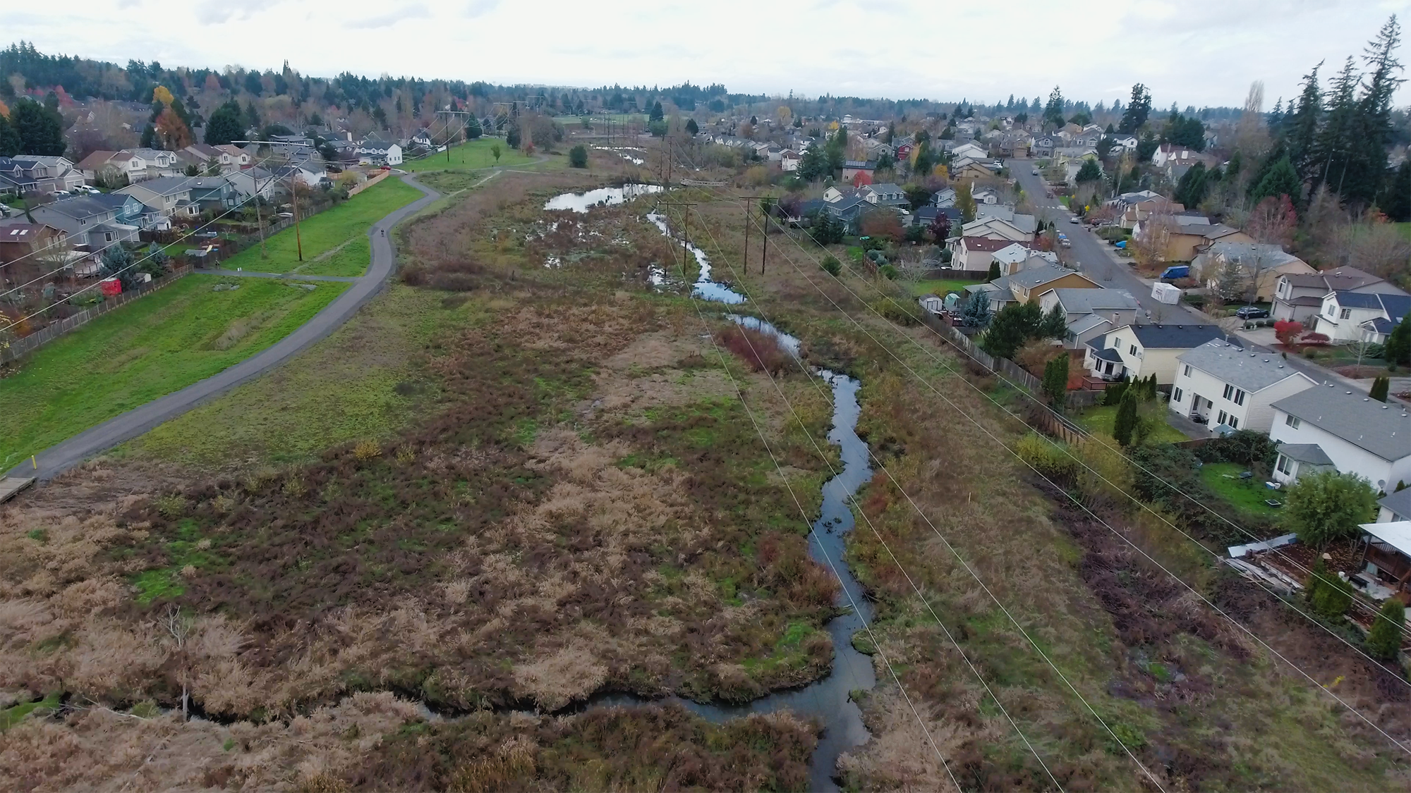
Springville Creek is a natural area in unincorporated eastern Washington County south of Portland Community College’s Rock Creek campus and north of Highway 26. Part of the Rock Creek Regional Trail System, this portion of Springville Creek is owned by Tualatin Hills Park & Recreation District (THPRD), a key partner in community outreach and education.
Each year, thousands of people regularly use the trail for recreation and as a transportation corridor to school and work. The area continues to grow rapidly, with residential housing and more development planned for the future.


The Site
First planting: 2009
Size: 41 acres
Stream length: 5,062 feet
Total to date: 249,714 plants
Plant communities: Riparian Forest, Scrub Shrub, Scrub Shrub Low Density PA, Upland Forest, Water Quality Facility
The Challenge
Springville Creek was channelized and overrun with non-native plants, resulting in a degraded system with limited habitat and swift flows that were digging the channel deeper and eroding the streambanks at an accelerated pace. Because the creek is located within a powerline corridor, techniques that were industry-standard at the time required modification.
Despite these challenges, strong community interest remained to enhancing this stream and improve the health of the creek corridor.
The Transformation
Transformation required several years of site preparation to control non-native plants. Clean Water Services (CWS) worked closely with THPRD, Portland General Electric (PGE) and Bonneville Power Authority (BPA) to develop planting plans that met all partners’ needs and avoided potential conflicts with ongoing powerline maintenance. Project staff also ensured the project complied with Clean Water Services’ vegetated corridor mitigation requirements.
Once non-native plants were under control, CWS completed minor grading to facilitate floodplain connectivity and placed logs in the floodplain to mimic natural conditions that also dissipating stream power during storm events, adding complexity and roughness, and providing habitat for wildlife. When log placement was complete, over 200,000 wetland plants, such as sedges, rushes and water-loving shrubs and trees were planted, following the agreed-upon planting plan.
Springville Creek also served as an outdoor test lab for different techniques to increase stream health and reduce costs. The partners found that:
Multi-year site preparation for removal of non-native plants is an essential step to reduce long-term management.
Studying reference sites and designing planting plans based on native plant density and diversity requirements ensures successful establishment of native plant communities and naturally excludes non-native species.
Establishing biodegradable fiber mats with wetland plants before placing them into a water quality facility (that filters stormwater runoff from streets) allows for quick plant establishment and immediate water treatment.
Placement of logs into a wetland system does not need to be highly engineered.
Springville Creek continues to support an abundance of native plants and wildlife. In recent years, beaver have returned and are further enhancing habitat complexity and improving site hydrology. The project is a showcase for what a successful urban creek corridor enhancement project looks like and how THPRD, CWS, BPA and PGE can partner to meet mutually beneficial goals like clean water, nature experiences and high-quality wildlife habitat.
66 native plant species
Plant cover change*
Native shrub/tree: +40%
Native herbaceous: +64%
Invasive: -42%
* Figures measure increase/decrease since monitoring began in 2010. Shrub/tree and herbaceous cover are measured only in plant communities appropriate to those species.

Click to explore the change in mature native plant coverage between 2007 (purple) and 2014 (orange).
Key Partners